
Growth Board Showdown: Bird Alliance vs. Thurston County Over Quarry Rezone
A dispute over what happens when mining ends on land surrounded by a national wildlife refuge and sensitive salmon habitat

by Ronda Larson Kramer
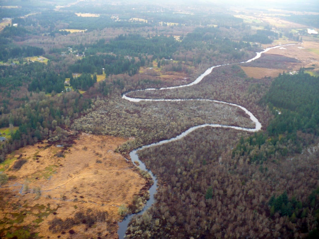
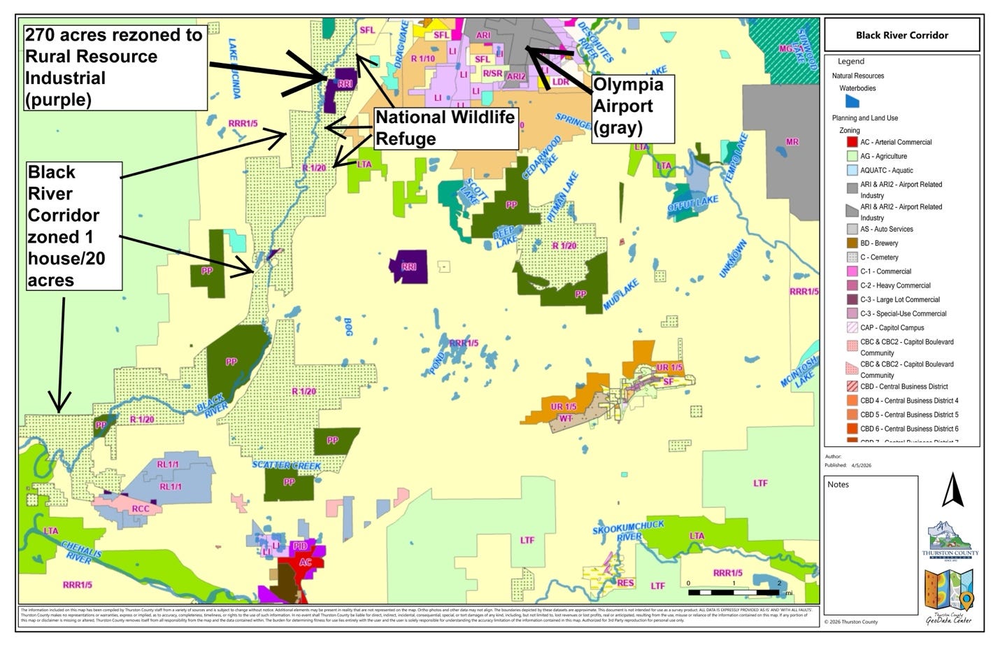
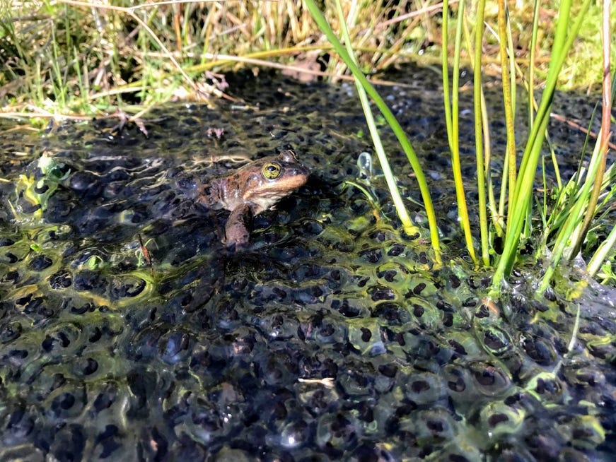
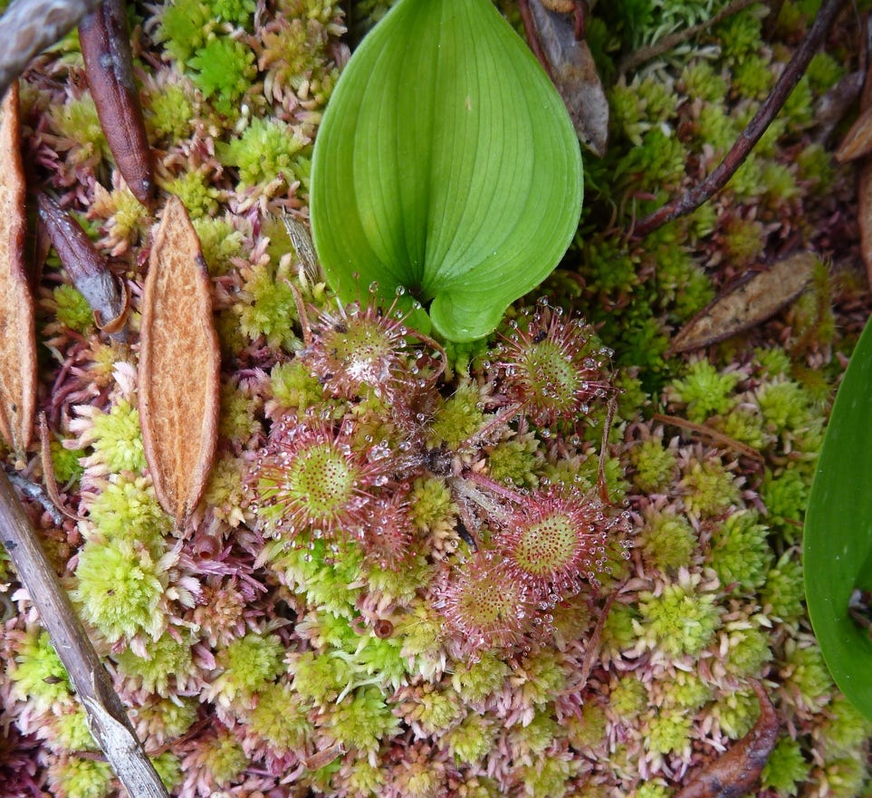
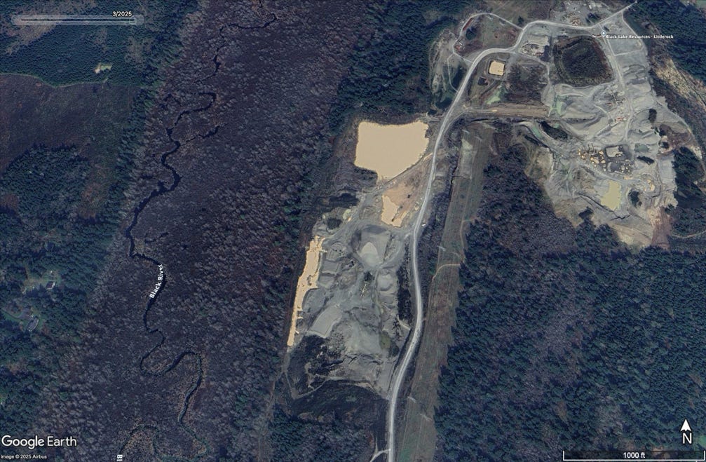
A more than 20-year effort to protect sensitive salmon habitat and one of the largest populations of Oregon spotted frogs in Washington entered a new phase in December, when Thurston County commissioners, by a vote of 4 to 1, approved an industrial rezone of approximately 270 acres in the Black River corridor, overriding a recommendation from the county’s Planning Commission to deny a rezone.
The change allows uses such as meat processing, pesticide distribution, fertilizer manufacturing, and landfills on land largely surrounded by a national wildlife refuge. South Sound Bird Alliance is now appealing the decision before the Growth Management Hearings Board.
At issue is how the County evaluated the future of the Black Lake Quarry. Under prior rural zoning that limited development to one home per 20 acres (Rural 1/20), the site was subject to reclamation requirements that included large-scale revegetation after mining ends. Under the rezone to a Rural Resource Industrial designation (RRI), the site can instead be developed for industrial uses. The question is whether the County adequately considered that difference in long-term futures—between restoration on one hand and continued industrial use on the other hand.
The Black River corridor has long been treated as a place where development should be limited. In 2007, in response to litigation by growth management watchdog Futurewise, Thurston County added protective zoning of Rural 1/20 along the entire Black River corridor. A 2007 county ordinance even calls out the Black River corridor as an example of what types of lands warrant the zoning classification of Rural 1/20. The ordinance identifies the corridor as an environmentally sensitive area where incompatible uses should be avoided.
That framework has shaped how mining has been allowed to proceed over the years. The expectation was not that the quarry would remain industrial, but that it would be returned to a vegetated landscape consistent with the surrounding corridor when mining was done.
The Department of Natural Resources approved a post-mining reclamation plan requiring the mine owner to plant approximately 440 trees and shrubs per acre across more than 200 acres—on the order of 100,000 plantings. Projects of that scale typically involve millions of dollars in revegetation costs. The rezone relieved the mine owner of that expense.
Planning commissioners, environmental advocates, and members of local Tribes who participated in the review process said the record did not support a rezone to industrial. The county Planning Commission voted 6 to 3 to recommend denial of the rezone. Its analysis looked at what the site is required to become after mining ends: large-scale revegetation in a zone that allows no more than one house per 20 acres versus more limited planting requirements under a Rural Resource Industrial zone.
But county staff and all but one member of the Board of County Commissioners applied a narrower framework. In a December 2, 2025, agenda-setting meeting, they solely compared the site’s current condition as an active mine to potential future industrial uses. Staff told commissioners that future industrial uses could result in a better environmental outcome compared to what the site looked like today, and that future development would be regulated through permitting and the County’s critical areas ordinances.
“The Planning Commission overwhelmingly voted to reject this proposal,” said Colin Bartlett, a member of the county Planning Commission. “We forwarded all of those findings in the trust that the Board would follow the evidence, our recommendation, and the expressed wishes of their constituents. … Instead, all it takes is a couple of motivated speakers to annul all of that when it benefits owners [of the mine].”
County Commissioner Emily Clouse, the sole member of the Board who voted against the rezone, explained at the December 2nd meeting why she would be voting against the rezone: “I just can’t, in good conscience, have that expanding industrial intensity in a hydrologically fragile ecosystem—without that scientific certainty—I just can’t support that.” Before the final vote on December 16, Clouse sought to give the Board more time to analyze the proposed rezone, but her motion failed 4 to 1.
In its August 2025 comment letter to the Board, the South Sound Bird Alliance wrote about the wildlife refuge largely surrounding the quarry, noting there is a “consensus of opinion, from legal, policy and advocacy points of view, on the extraordinary environmental vulnerability of this area and the need to strictly limit land uses adjacent to it.”
Sue Danver, who South Sound Bird Alliance called one of the “strongest, most passionate and committed advocates” of the natural world when she passed away in 2025, had devoted considerable time to protecting the Black River Corridor, according to her husband Bob Metzger who testified at the rezone’s November hearing.
Metzger told the Board that Danver “and the Black Hills Audubon Society spent years, untold hours of volunteer effort, and over $60,000 for experts and lawyer fees…to protect the Black River and the adjacent wildlife refuge from degradation caused by inappropriate industrial uses and to see that the area was restored to functioning habitat once the gravel mining was completed. That was over 20 years ago. …[T]he current rezone…would…ensure that the parcel will never again provide any usable habitat for birds and wildlife.” Metzger is also a party to the appeal.
Beowulf Brower, who kayaks and hunts on the Black River, said at the hearing in November that the rezone would negatively impact recreation and tourism, “undermining years of effort by groups like CNLM [Center for Natural Lands Management], Ducks Unlimited, the Audubon Society, and the Chehalis Tribe.”
County resident Brett Clubbe told the Board before its final vote that the rezone “benefits one landowner while shifting long-term costs onto the public.”
The dispute is not only about environmental risk, but also about how the County justified the rezone under its own planning framework.
Commissioners cited a need for additional Rural Resource Industrial land, relying in part on the County’s 2023 Industrial Lands Study. That study describes the RRI zone as intended for industrial uses tied to agriculture, forestry, and mineral extraction, with controls designed “to establish compatibility with surrounding rural development and offer protection from industrial blight and impacts.”
The study also explains that more intensive industrial uses are limited by specific location and performance criteria, including proximity to an Interstate 5 interchange, access to arterial roads, and availability of rail service. “These conditions limit the area in which RRI-zoned land can support more intensive industrial uses to the Maytown Interchange,” the study states, identifying approximately 97 acres of developable land under those constraints.
On the same day the Board approved the rezone, it also amended the development code to remove those same constraints: the requirements tying Rural Resource Industrial uses to proximity to Interstate 5, rail access, and arterial roads. As a result, the locational constraints described in the Industrial Lands Study no longer applied, and land that previously could not accommodate those uses became newly eligible across the county. The Board did not address those changes in connection with its decision to rezone Black Lake Quarry.
Leading up to the vote, the chair of the Board, Commissioner Tye Menser, said his understanding of the study was that while the county has sufficient industrial land overall, there are gaps in the availability of large, fully serviced sites. “I heard several people say that we don’t need industrial lands… And then heard other people say, ‘Well, we do need larger parcels,’” he said. “My recollection was that Thurston County had enough industrial land, . . . but there were deficiencies in having large parcels with utility access.”
Gordon White, a former Thurston County planner who developed the first industrial lands studies in Thurston County in the 1980s and early 1990s, joined the South Sound Bird Alliance in appealing the rezone. He said the need for large industrial parcels is already addressed through land assembly. “Costco in Tumwater recently bought multiple smaller adjacent parcels, which, when combined, met its need for a larger parcel,” he said.
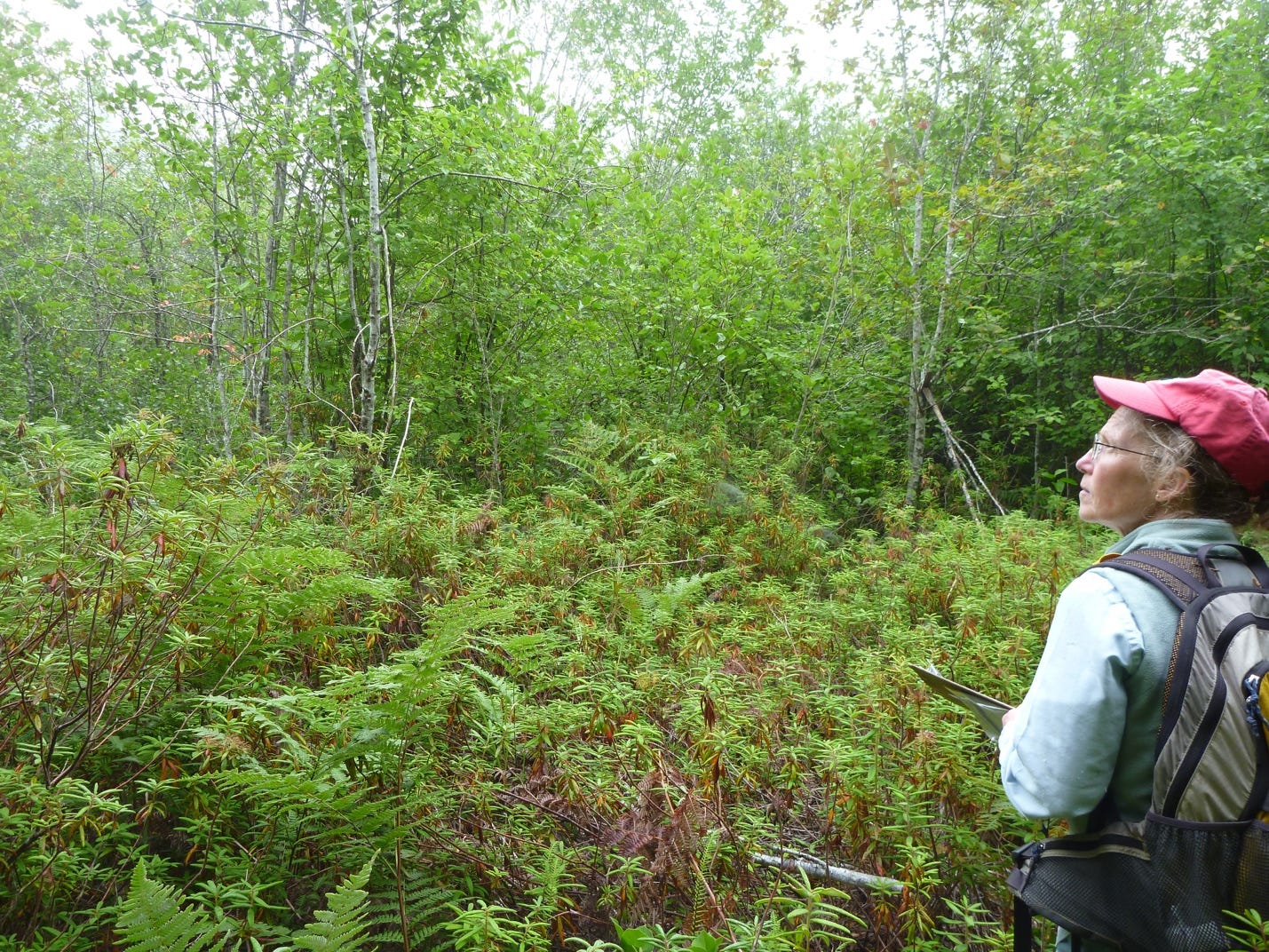
The Board’s process of analysis contrasted with that of the Planning Commission, which was shown pictures of mines that had been restored, including one mine that is now salmon habitat.
“We reviewed hundreds of documents, reports, studies, testimonies, and public comments from community members, nonprofit stewards, scientists, lawyers, and stakeholders, all overwhelmingly opposed to this rezone,” said Planning Commissioner Colin Bartlett. “The voices in favor were almost unanimously developers, industry figures, and paid consultants of those who stood to unilaterally profit off of a rezone.”
Before the Board took its final vote to approve the rezone, Thurston County resident Elizabeth McNagny urged it to consider the fact that the county has enough industrial lands already. “When adequate capacity already exists, expanding industrial zoning is not driven by need — it is a discretionary policy choice. And making that choice next to a national wildlife refuge does not make sense.”